
|
There are many different types of map projections and each have different strengths and weaknesses related to accuracy. Maps can be distorted in 3 ways; shape, area and distance.
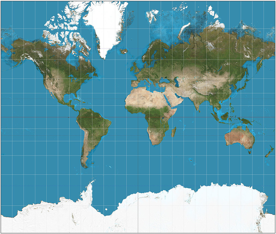
To your left, you will find the classic Mercator Projection. Developed by Gerardus Mercator in 1569, it is a projection that was favored by ships captains during sea-travel because it preserved direction. However, the land masses get more distorted the closer you get to the poles. As a result, Greenland, an island country, looks larger than Africa, the world's second largest continent. |
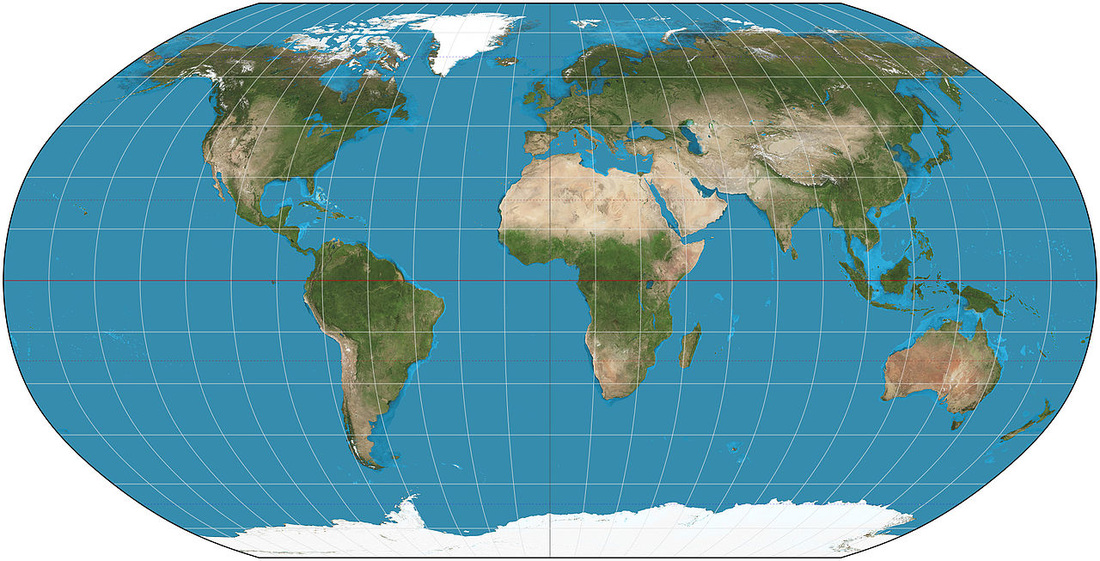
Robinson ProjectionThe Robinson Projection attempts to preserve the shape and size of the landmasses better than the Mercator Projection.
|

Interrupted ProjectionThe Interrupted Projection does the best job of preserving the relative size of the landmasses; however, it butchers our oceans.
|
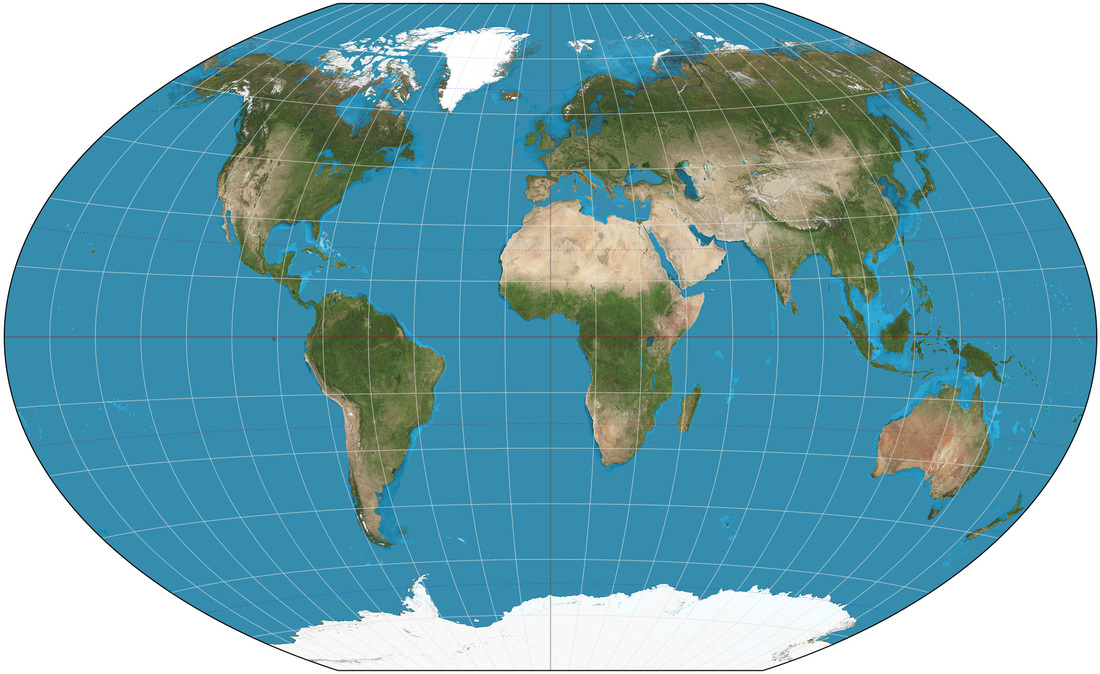
Winkel-Tripel ProjectionThe Winkel-Tripel projection is slightly more accurant than the Robinson at preserving the size and shape of landmasses, and is the favored projection for world maps today.
|
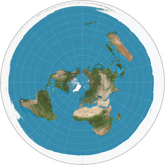
AZIMUTHAL PROJECTION
An Azimuthal Projection is any map projection in which a region of the earth is projected onto a plane tangential to the surface, typically at a pole or the equator.
An Azimuthal Projection is any map projection in which a region of the earth is projected onto a plane tangential to the surface, typically at a pole or the equator.
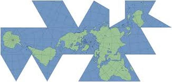
Fuller's Dymaxion
The Dymaxion map or Fuller map is a projection of a world map onto the surface of an icosahedron, which can be unfolded and flattened to two dimensions. The flat map is heavily interrupted in order to preserve shapes and sizes.
The Dymaxion map or Fuller map is a projection of a world map onto the surface of an icosahedron, which can be unfolded and flattened to two dimensions. The flat map is heavily interrupted in order to preserve shapes and sizes.
OTHER TYPES OF MAPS
There are several types of maps. Each type shows different information. Most maps include a compass rose, which indicates which way is north, south, east and west. They also include a scale so you can estimate distances. Here's a look at some different types of maps.
There are several types of maps. Each type shows different information. Most maps include a compass rose, which indicates which way is north, south, east and west. They also include a scale so you can estimate distances. Here's a look at some different types of maps.
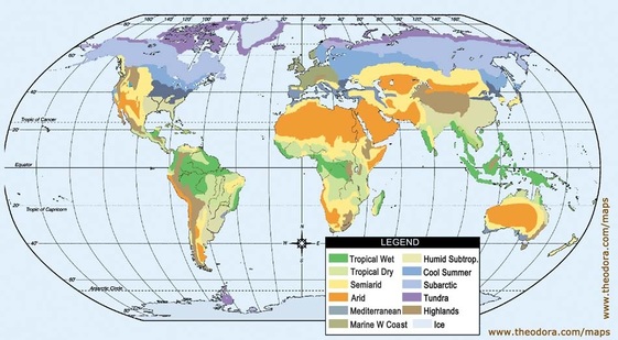
Climate maps
give general information about the climate and precipitation (rain and snow) of a region. Cartographers, or mapmakers, use colors to show different climate or precipitation zones.
give general information about the climate and precipitation (rain and snow) of a region. Cartographers, or mapmakers, use colors to show different climate or precipitation zones.
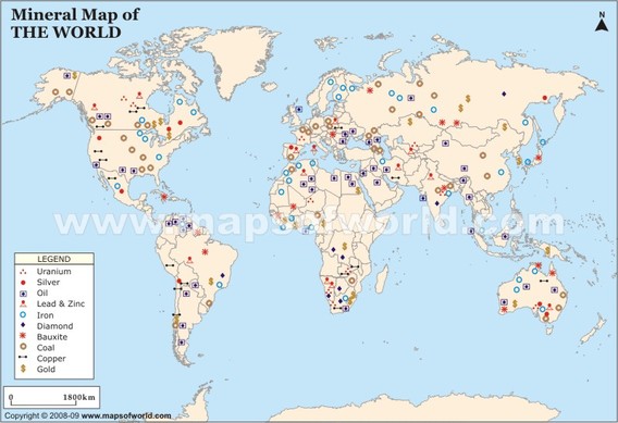
Economic or Resource maps
feature the type of natural resources or economic activity that dominates an area. Cartographers use symbols to show the locations of natural resources or economic activities. For example, oranges on a map of Florida tell you that oranges are grown there.
feature the type of natural resources or economic activity that dominates an area. Cartographers use symbols to show the locations of natural resources or economic activities. For example, oranges on a map of Florida tell you that oranges are grown there.
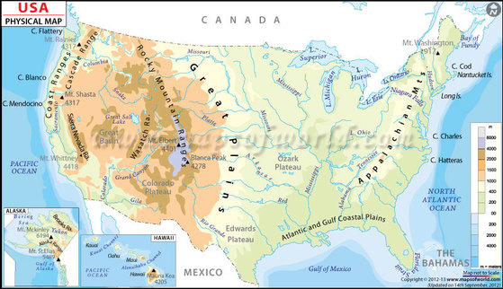
Physical maps
illustrate the physical features of an area, such as the mountains, rivers and lakes. The water is usually shown in blue. Colors are used to show relief—differences in land elevations. Green is typically used at lower elevations, and orange or brown indicate higher elevations.
illustrate the physical features of an area, such as the mountains, rivers and lakes. The water is usually shown in blue. Colors are used to show relief—differences in land elevations. Green is typically used at lower elevations, and orange or brown indicate higher elevations.
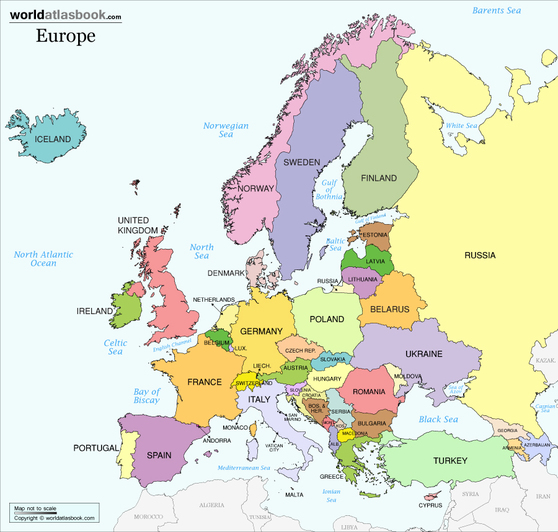
Political maps
do not show physical features. Instead, they indicate state and national boundaries and capital and major cities. A capital city is usually marked with a star within a circle.
do not show physical features. Instead, they indicate state and national boundaries and capital and major cities. A capital city is usually marked with a star within a circle.
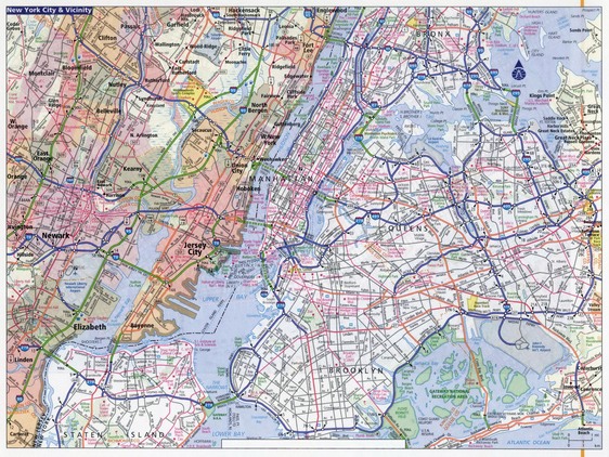
Road maps
show major—some minor highways—and roads, airports, railroad tracks, cities and other points of interest in an area. People use road maps to plan trips and for driving directions.
show major—some minor highways—and roads, airports, railroad tracks, cities and other points of interest in an area. People use road maps to plan trips and for driving directions.
Demographic Maps
a map that shows studies of a population based on factors such as age, race, sex, economic status, level of education, income level and employment, among others.
a map that shows studies of a population based on factors such as age, race, sex, economic status, level of education, income level and employment, among others.
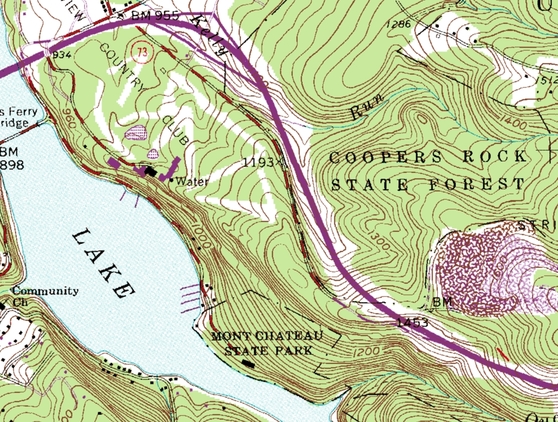
Topographic maps
include contour lines to show the shape and elevation of an area. Lines that are close together indicate steep terrain, and lines that are far apart indicate flat terrain.
include contour lines to show the shape and elevation of an area. Lines that are close together indicate steep terrain, and lines that are far apart indicate flat terrain.
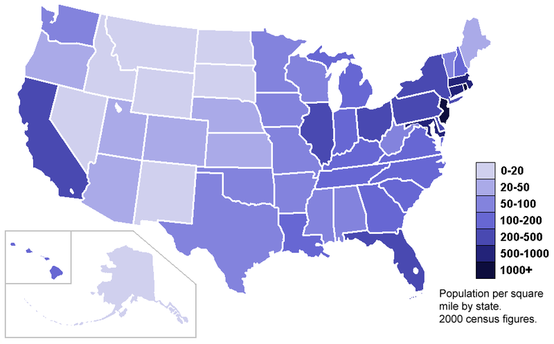
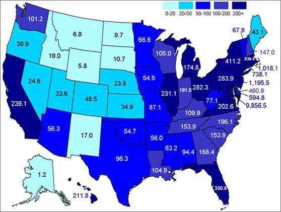
Choropleth Maps
a map that uses differences in shading, coloring, or the placing of symbols within predefined areas to indicate the average values of a property or quantity in those areas.
